Difference between revisions of "Razor Hills"
m (Moose link led to wrong moose. Perhaps disambiguation page needed for RH moose, OBB moose and CG moose at some point.) |
|||
| Line 3: | Line 3: | ||
===[[Heraldry]]=== | ===[[Heraldry]]=== | ||
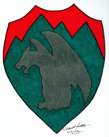
| − | + | [[File:Razorhills-heraldry.jpg|200px]] | |
===History=== | ===History=== | ||
Revision as of 02:48, 7 December 2010
A Shire of The Emerald Hills, located in Fayetteville, Arkansas
Heraldry
History
Founded in 2009 by Moose_RH, Joined the Emerald Hills in June of 2010.
People
Officers
Contacts and Directions
we will be starting on Sunday, January 3rd at Finger Park, located in beautiful Fayetteville, AR.
directions can be found on google maps, but just in case...
it coming from the west, take highway 62 east into AR and head into Fayetteville. you'll be looking for Farmers Rd. take a right onto Farmers and drive for a minute; the park will be right in front of you. there will be a Verizon Wireless dealership on the corner of Farmers and Highway 62, so you'll know where to turn. triple AAA storage will be across the street.
and if anybody is coming from Tulsa, just hop on I-540 south into AR, and take the Martin Luther King Jr. Blvd exit. you'll merge onto several lanes (so be careful) and you'll turn right heading west onto Highway 62 when you get to the end of the exit. when you see the Verizon Wireless building and Farmers Rd, turn left onto Farmers and follow the road until you see the park.
if coming from Ft. Smith, take I-540 north until you hit the Martin Luther King Jr. Blvd exit. you'll go around to the right until you hit a service road. take a left and go Martin Luther King Jr. Blvd. go left onto it, go under the overpass and continue until you come up on Farmers. take a left and follow.
